Altdorf to Engelberg via Surenen Pass 
Distance: 8.9 - 13.0 miles (one way)
Bernese Oberland, near Altdorf in The Bernese Oberland
The Alpine Pass Route from Altdorf to Engelberg ascends through meadows framed by rugged peaks to Surenen Pass where Titlis and the Schloss and Spannort massifs dominate the view. The scenic descent to Engelberg features views of towering, jagged peaks adorn with waterfalls and a dramatic cirque.
See Trail Detail/Full Description
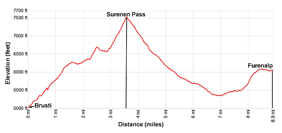
- Distance: 3.6 miles (one way) to Surenen Pass
13.0 miles (one way) to Engelberg - Elevation: 5,003-ft. at Trailhead
7,516-ft. at Surenen Pass
3,287-ft. at Engelberg - Elevation Gain: 2,513-ft. to Surenen Pass
-4,229-ft. to Engelberg - Difficulty: strenuous
- More Hikes in:
Altdorf / Engelberg / The Bernese Oberland
Why Hike Altdorf to Engelberg via Surenen Pass
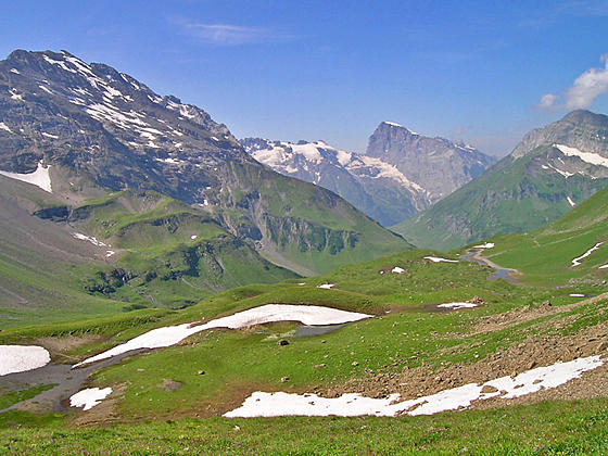
This beautiful hike ascends along a high ridge beneath the steep cliffs of the Brunnistock and Blackenstock before climbing rocky alpine meadows and scree covered slopes to Surenen Pass, a panoramic saddle where snow-capped Titlis (10,623-ft.) is the star of the show. The scenic descent from the pass, through meadows and pastures, enjoys amazing views of the cirque towering above Blackenalp and the waterfalls spilling down the glacier-clad Schloss and Spannort massifs rimming the south side of the Surenen Valley.
The trail is part of the Alpine Pass Route between Altdorf to Engelberg. This description shortens the hike to a more manageable day by taking the cable car from Attinghausen, west of Altdorf, to Brusti and then climbing to Surenen Pass. Various options are also available to reduce the mileage and eliminate the final segment of the walk along roads to Engelberg.
Elevation Profile

Support our Site | |
Trail Resources
Trail Detail/Full Description / Trail Photo Gallery / Trail Map
Basecamp(s) Information:
Altdorf / Engelberg
Region Information:
The Bernese Oberland
Other Hiking Regions in:
Switzerland

